Washington State is very strong in its state parks system, due, no doubt, to its abundant natural beauty, and the creation of the CCC corps back in the 1930s. One of the popular parks in the state is Deception Pass State Park. It not only has a beautiful two-part bridge over the pass itself, but also beaches, campsites, picnic facilities, and plenty of hiking.
Rosario Beach & Trail
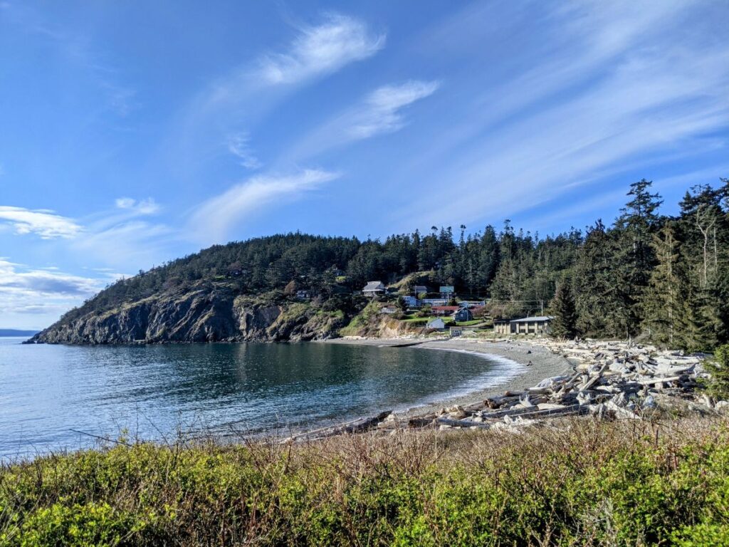
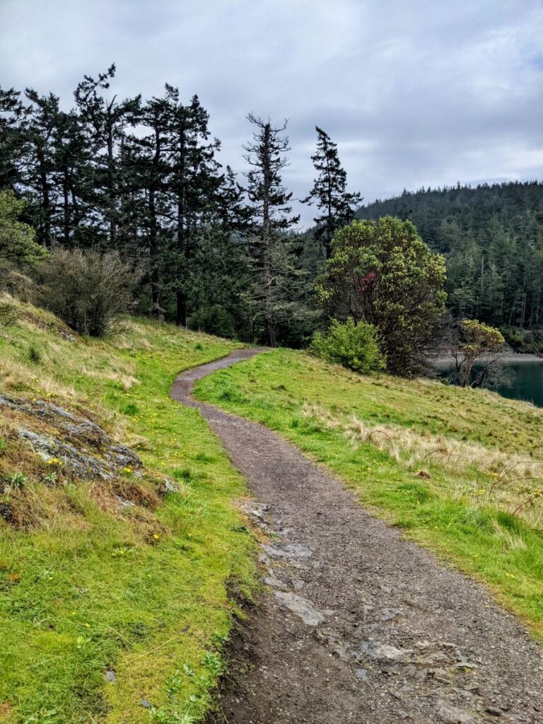
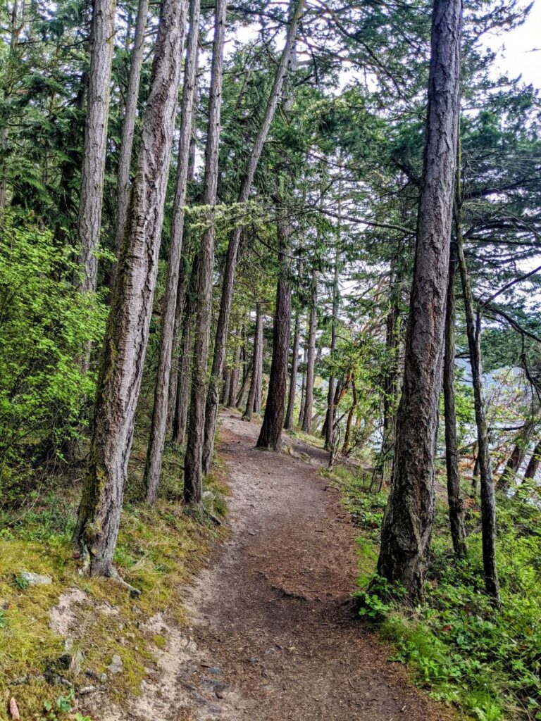
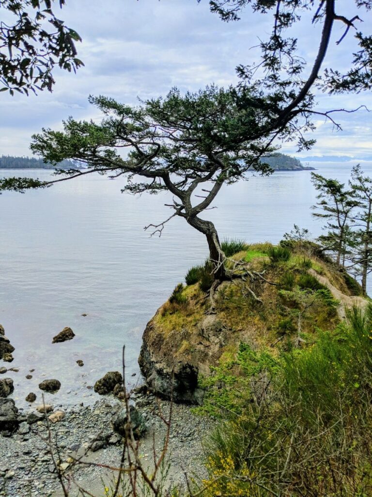
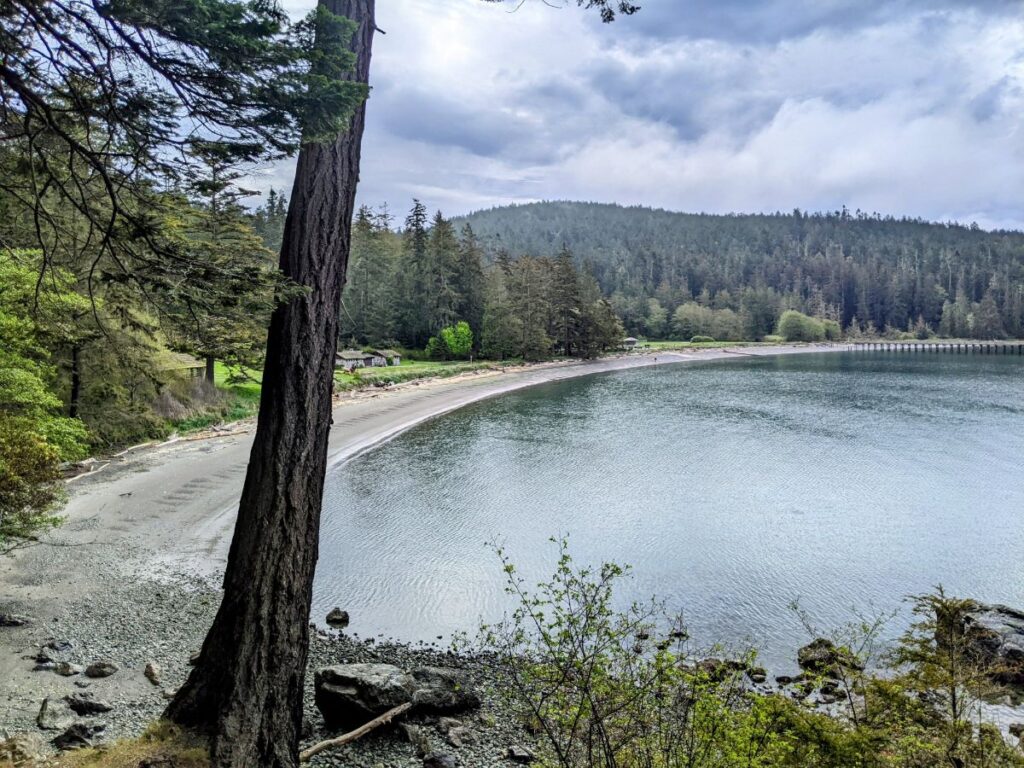
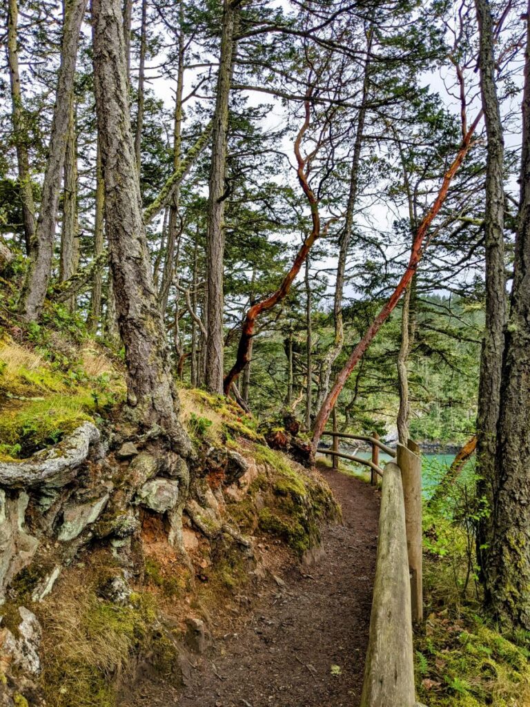
I took one popular trail – the Rosario Beach Trail – from one beach cove to another, along a rocky shoreline with beautiful views. On one end is Rosario Beach with small waves gently lapping against the shore. There’s also a large grass lawn, picnic shelters, bathrooms, and parking available.
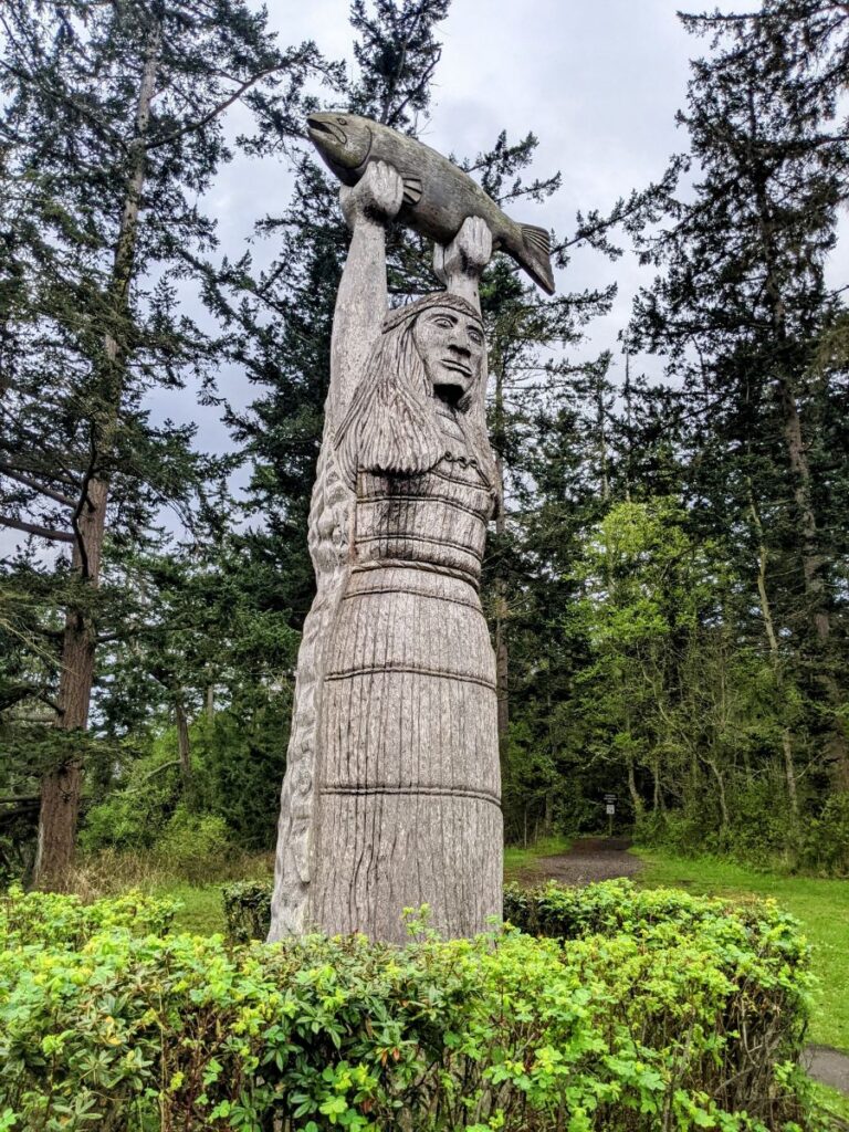
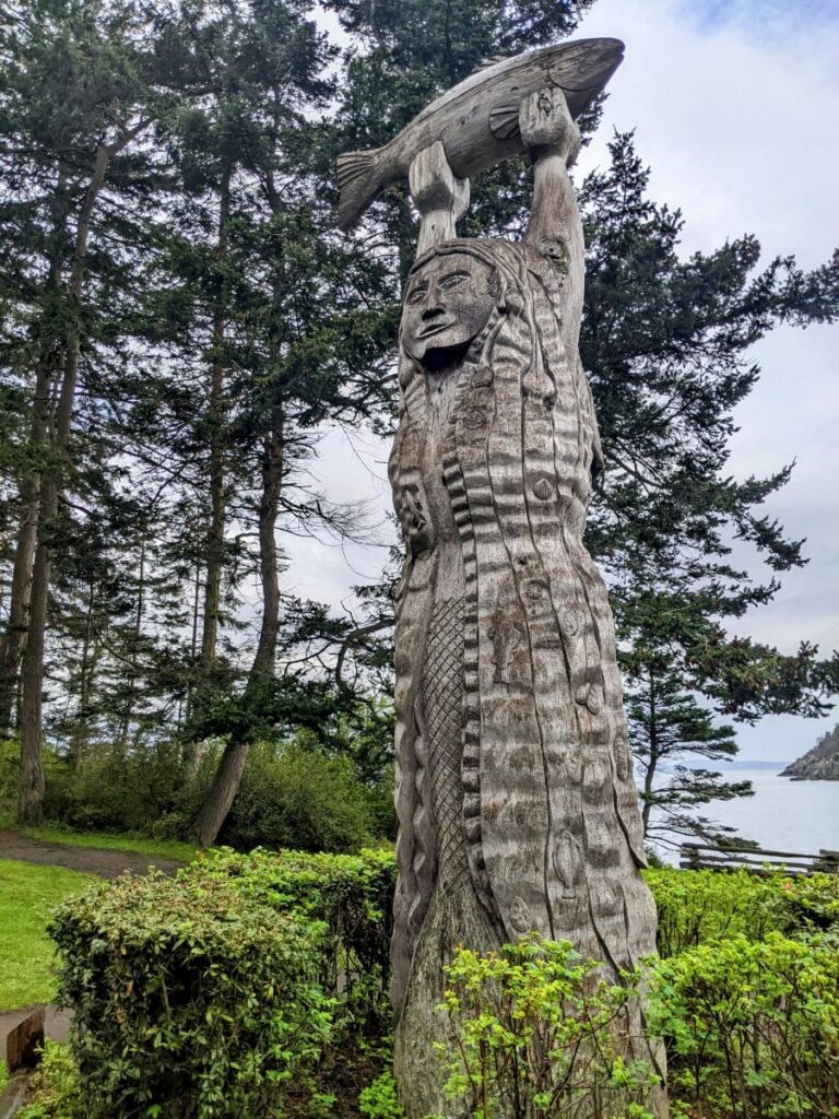
Above the beach is a really cool wooden sculpture depicting the Maiden of Deception Pass. The story is told around its base about a native Samish woman who married the king of the Salish sea and her transformation into a creature of the sea herself. The statue features two sides – one of her as she was on land, and the other as a mermaid with shells in her hair.
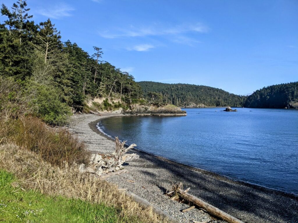
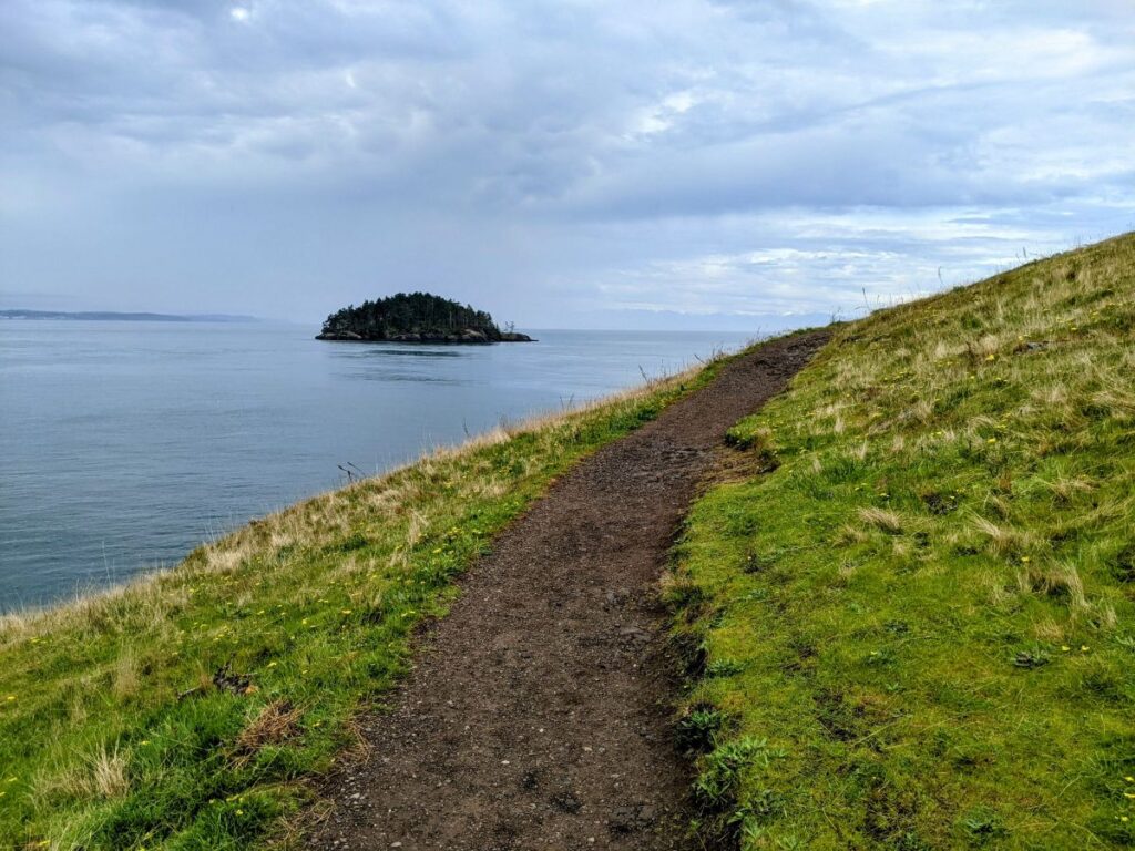
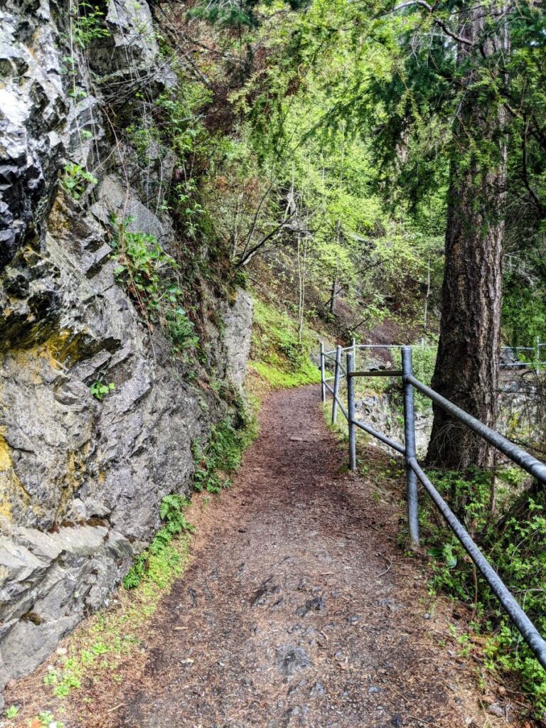
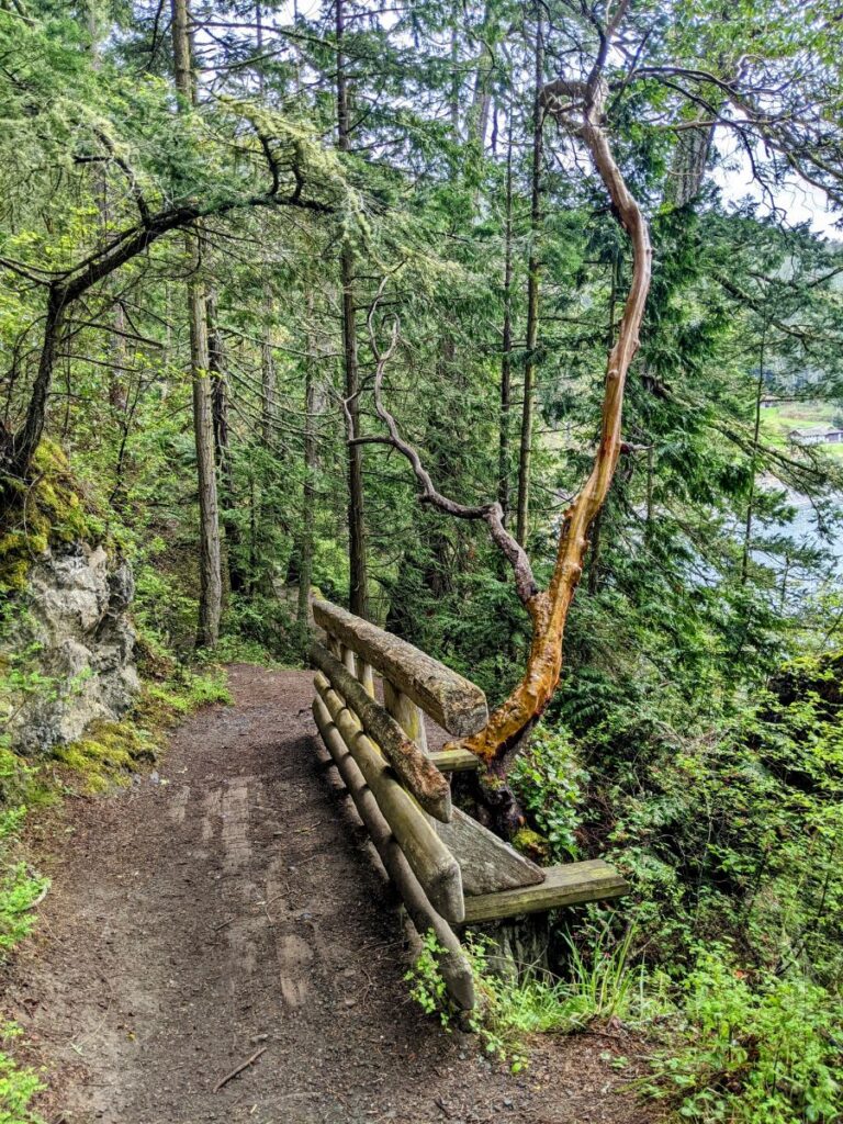
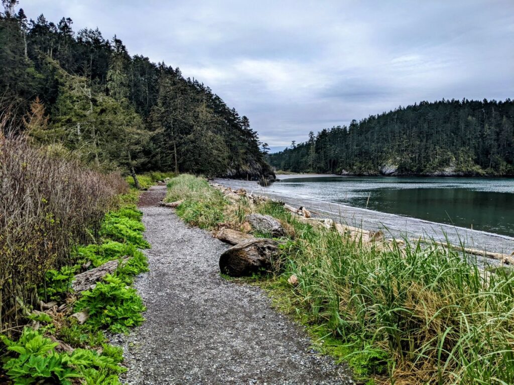
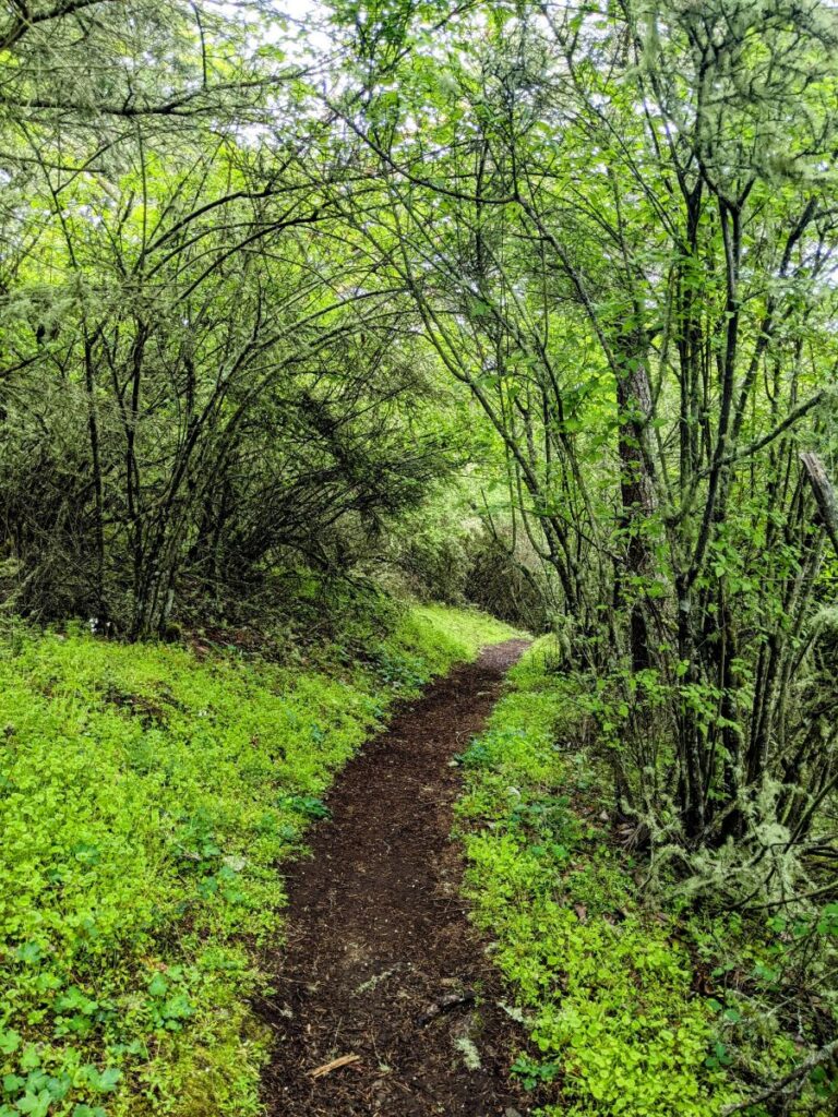
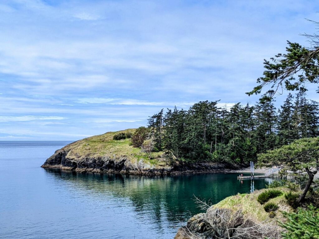
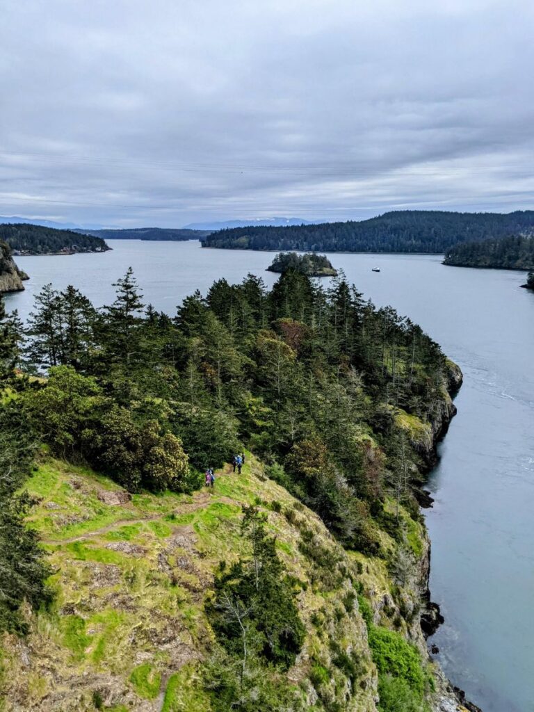
Beyond the maiden is a shortish loop around Rosario Head. Then you can continue your hike toward Bowman Bay. This a beautiful walk along the cliff’s edge until you get to Bowman Beach. If you walk all the way down Bowman Beach, you can continue your hike either on the Lottie Point Loop or the Lighthouse Point Loop. I took Lottie Point since it is smaller and I was getting tired, but it’s closer to road traffic, which you can definitely hear from the trail. The trails aren’t uniformly easy, but they’re far from difficult.
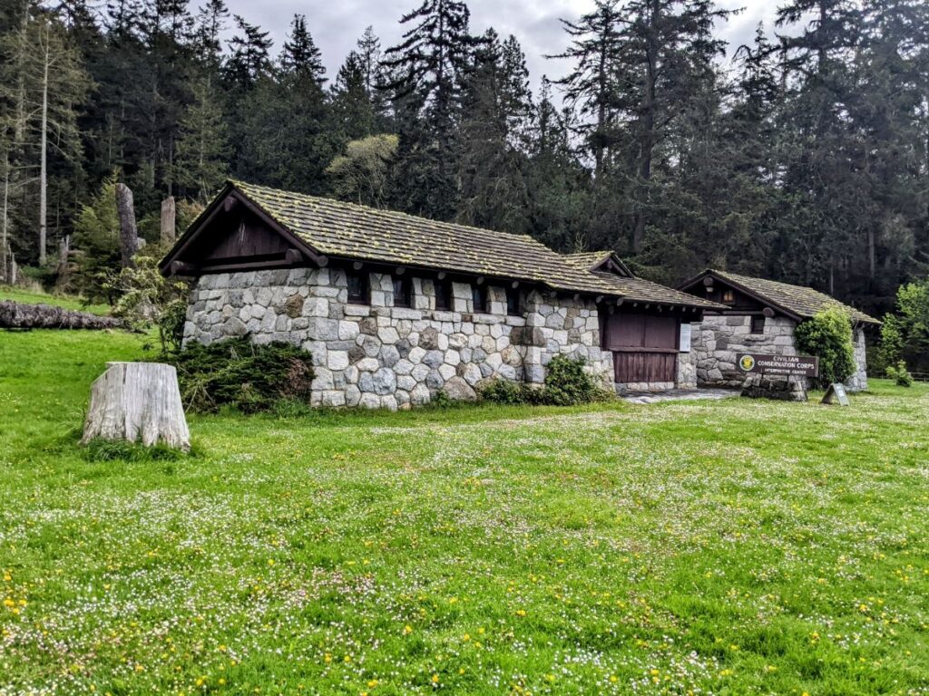
Civilian Conservation Corps Interpretive Center
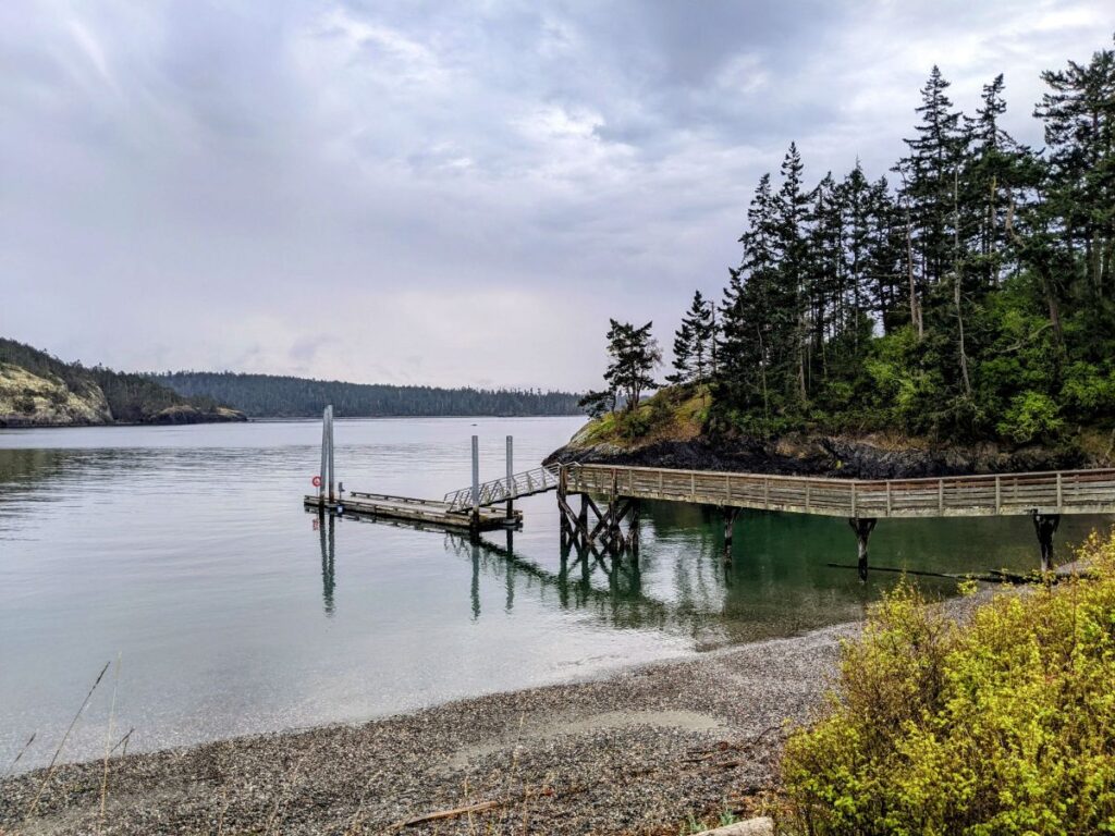
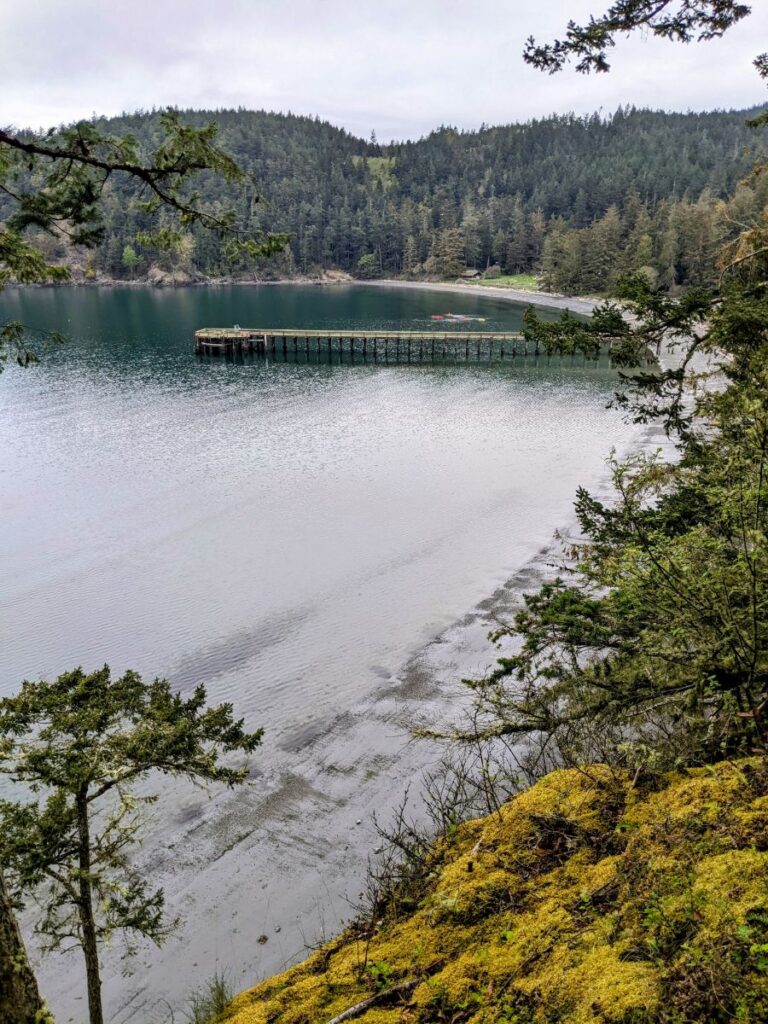
Bowman Beach (or maybe it’s Friendship Beach – either way, it’s the beach on Bowman Bay) is bigger than the Rosario Beach area. There are more wide open spaces, parking, a boat ramp, and even a small campground here.
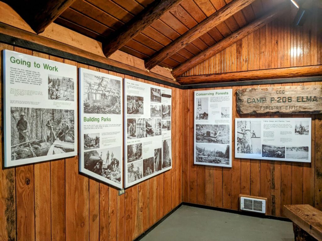
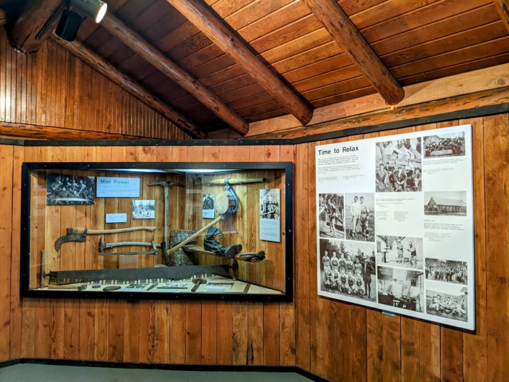
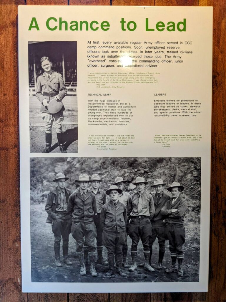
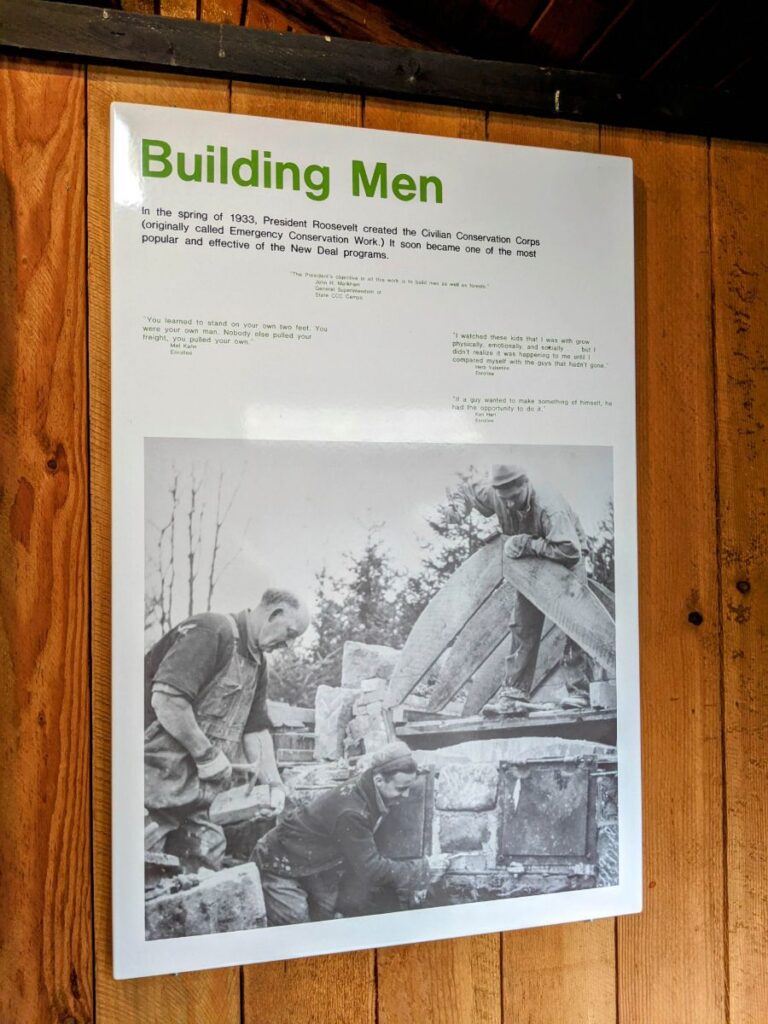
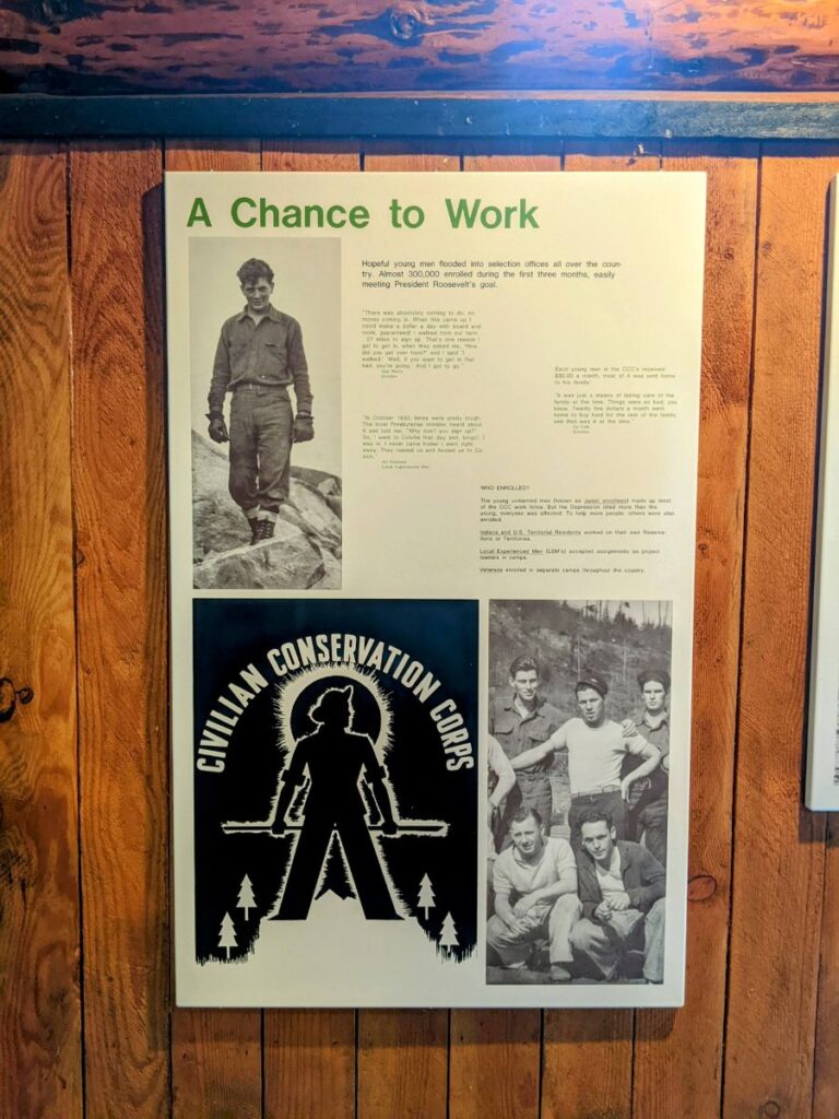
But most interesting to me is the Civilian Conservation Corps Interpretive Center, which happened to be open when I walked by. Inside the cabin (made by the CCC, obv.) it details the program, its projects, and benefits to the men who were involved. There are lots of photos, and even a video, along with tools, clothes, and games used at the time.
A short history: the CCC was a Depression-era New Deal government program that put young, unmarried men to work at a time when unemployment was around 25%. It was almost all manual labor – they built the state parks, trails, picnic shelters & bathrooms, fire lookout towers, did erosion & flood control, forestry & fire protection, and more. The men lived in camps run by the Army and had a structured existence, but no military training of any kind, Instead, professional craftsmen would teach the men on each project and oversee their work. This offered the men payment – most of which they sent home – discipline, and a sense of purpose. Not to mention three good meals a day, which they were usually not getting at home. The program lasted from 1933-1942 and employed over 3 million men.
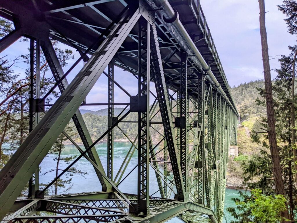
Deception Pass Bridge
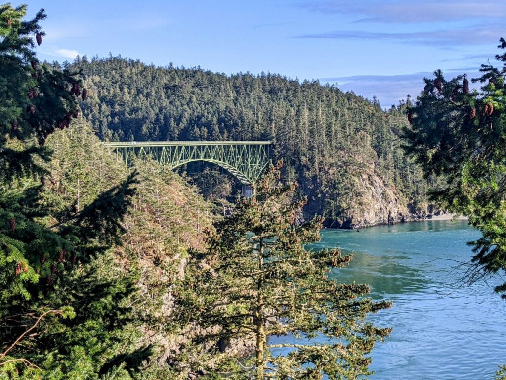
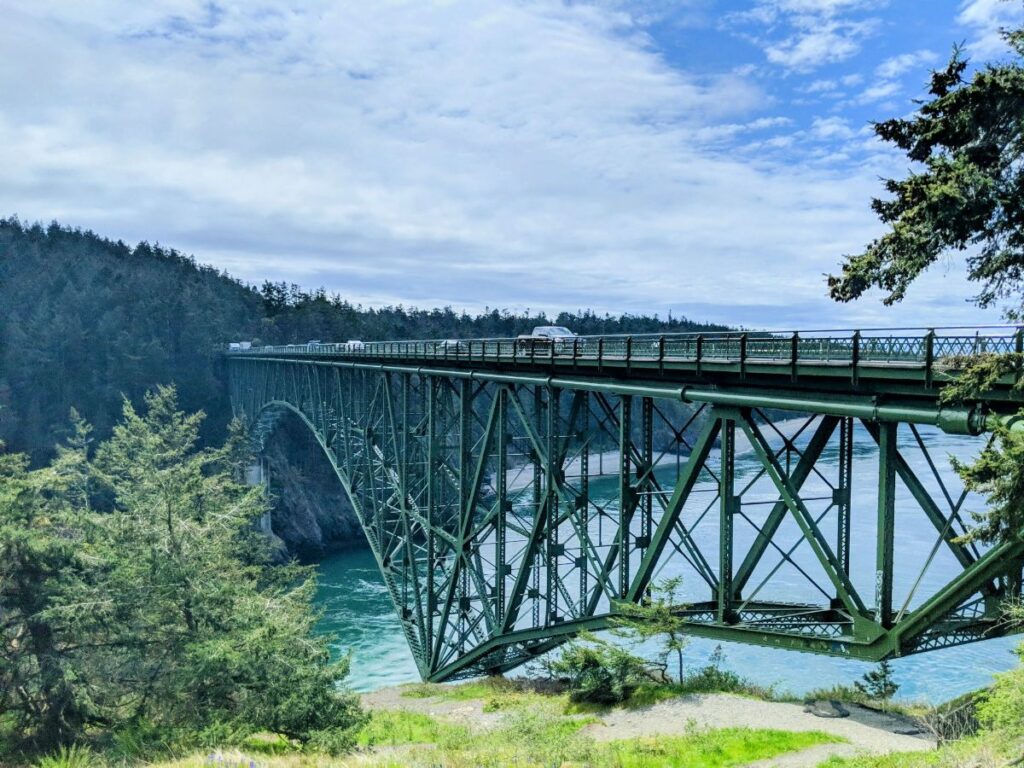
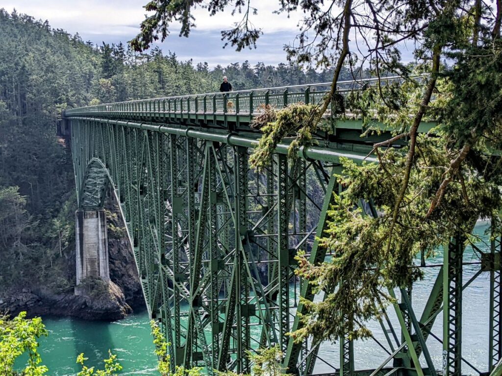
One of the main sights in Deception Pass State Park is Deception Pass Bridge, a beautiful arched bridge over Deception Pass itself. This area gets a lot of traffic since it’s the main artery from the Anacortes area down to Whidbey Island and one way to get to Seattle.
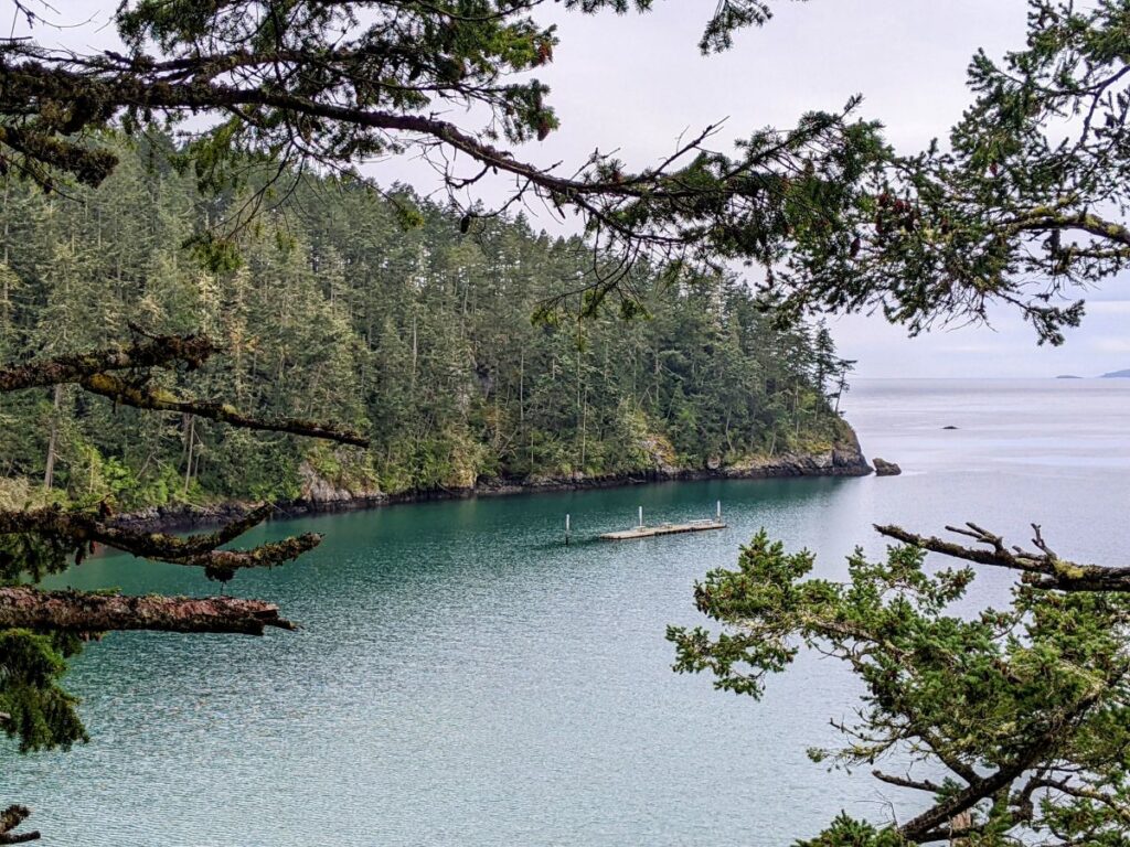
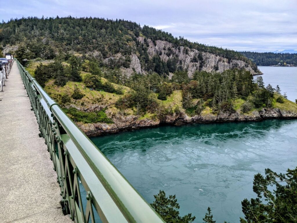
There are actually two bridges, one over Deception Pass and one over Canoe Pass. There are smaller areas to park around the bridges and some places to pull over, but the largest and most convenient parking lot is just south of Deception Pass. This parking lot even has bathrooms. Another lot on a loop can be found by driving farther south into the main campground, then driving back directly north as far as you can go. This places you below the bridges and you can walk up to them, as well as a loop trail around Goose Rock. There are pedestrian walkways on either side of the bridges, but the only way to cross the street is by crossing under the bridge using stairs.
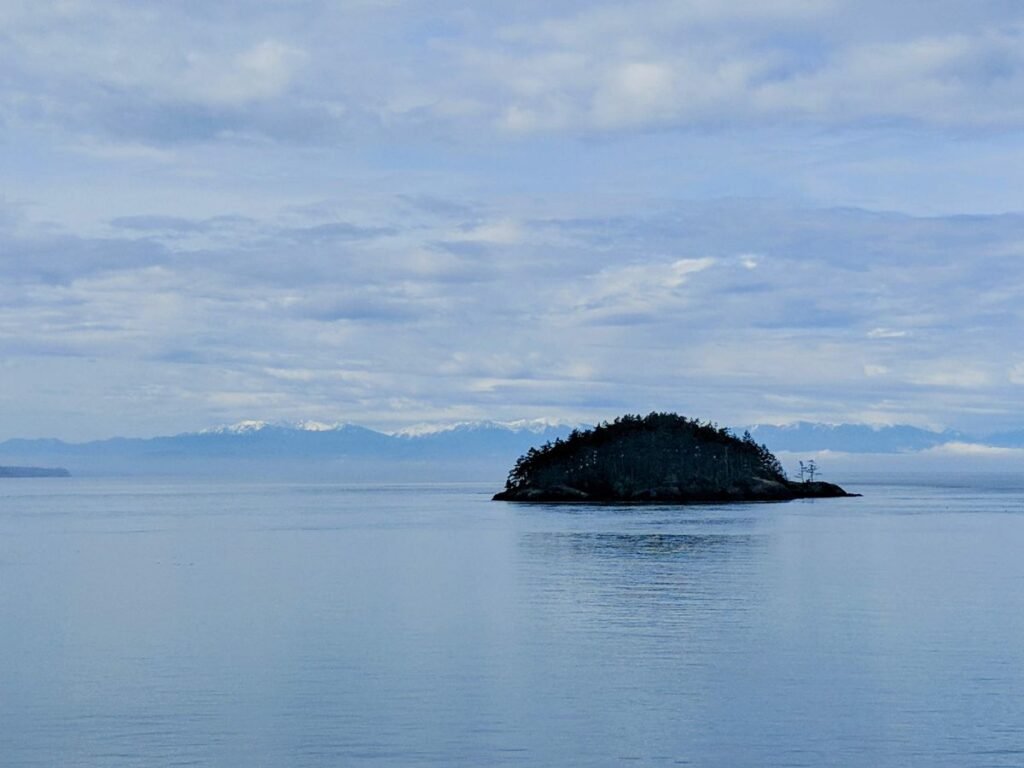
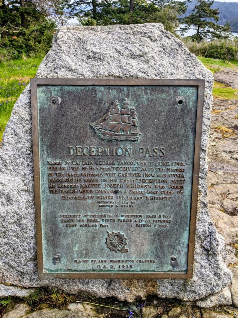
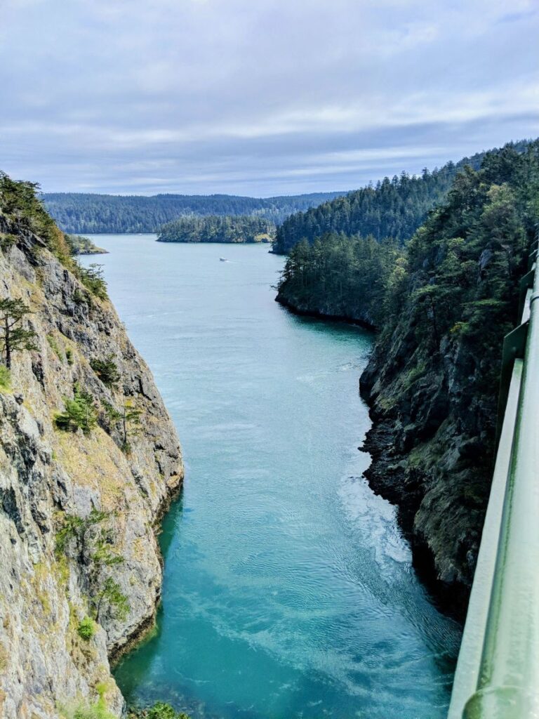
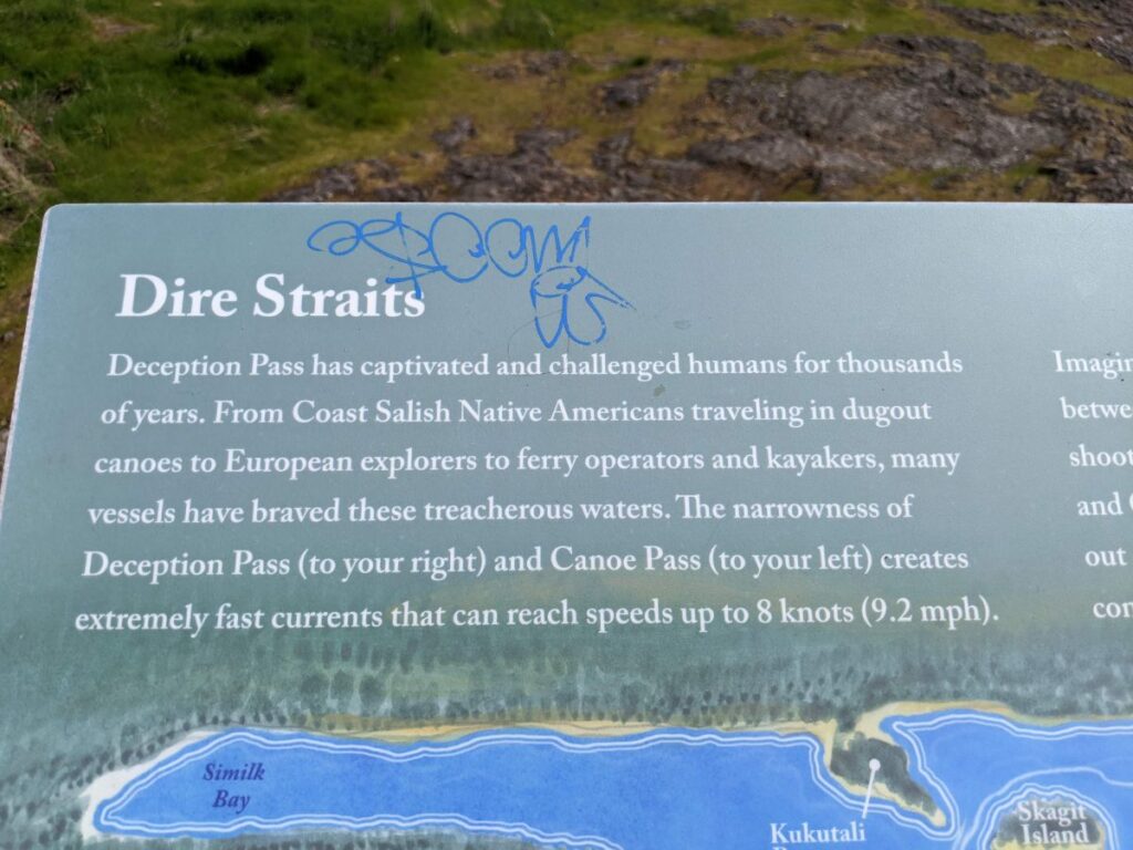
Deception Pass was so named by Captain George Vancouver in 1792 due to the treacherous nature of its currents. As the tide moves in and out, water from either side rushes through the strait at speeds of up to 8 knots. So while it’s very deep, it can get very unruly to try to navigate. Looking down from the bridges, it’s fascinating to see the deep water churn and flow. It’s less like waves or rapids and more like watching a huge tide of water surge up from below.

More of Deception Pass State Park
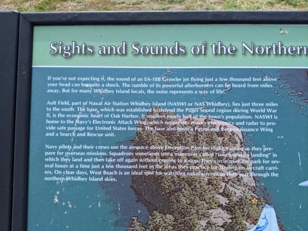
Farther south of the bridge you come to the main entrance of the park. Turning in here across from an RV campground is the Cranberry Lake campground check-in. Beyond that, there’s a wide beach with lots of parking and a big facilities building. (And planes flying overhead from the nearby air base.) Also camping, hiking, and lots of picnic areas with trees and shoreline. It’s from this entrance that you can drive north to more parking for the bridge and different beach areas.
I turned in here and drove around, but I only got out once and didn’t take many good pictures. It looks like it is a very popular spot in the middle of summer.
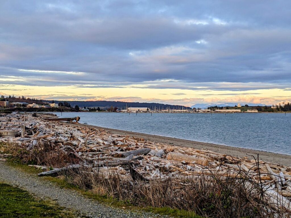
Whidbey Island
I suppose I’m going backward from how most people experience Deception Pass State Park, if they’re coming up from Seattle. I was making my way down from Anacortes toward Seattle, and did so by driving down through long and narrow Whidbey Island.
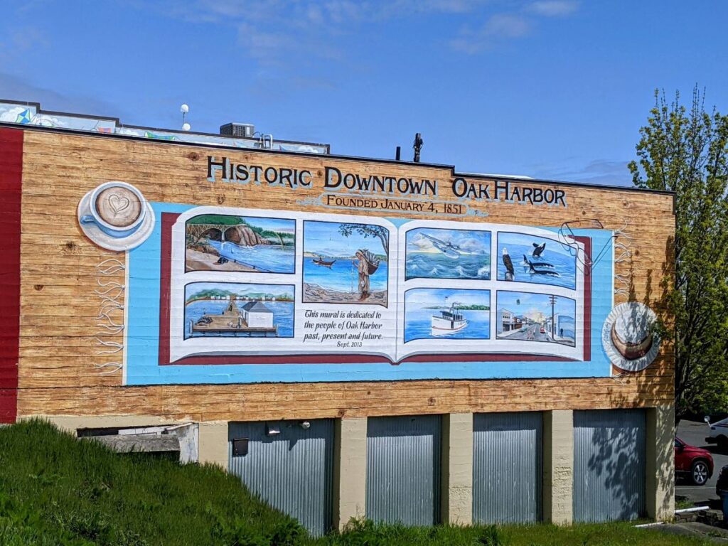
Oak Harbor
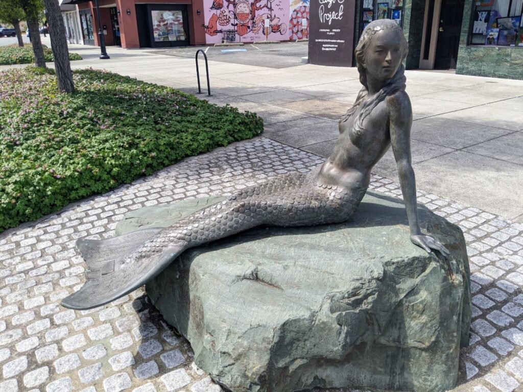
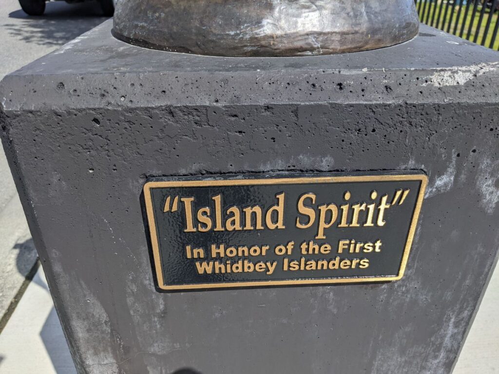
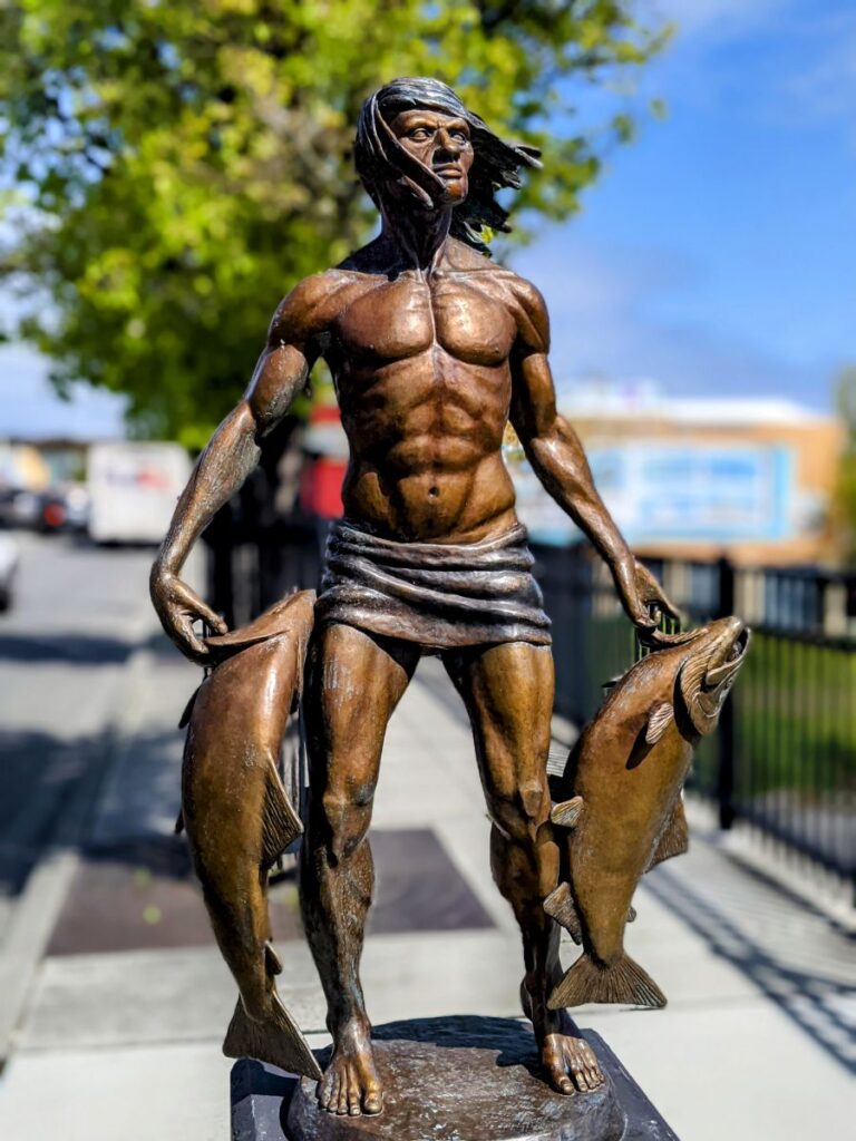
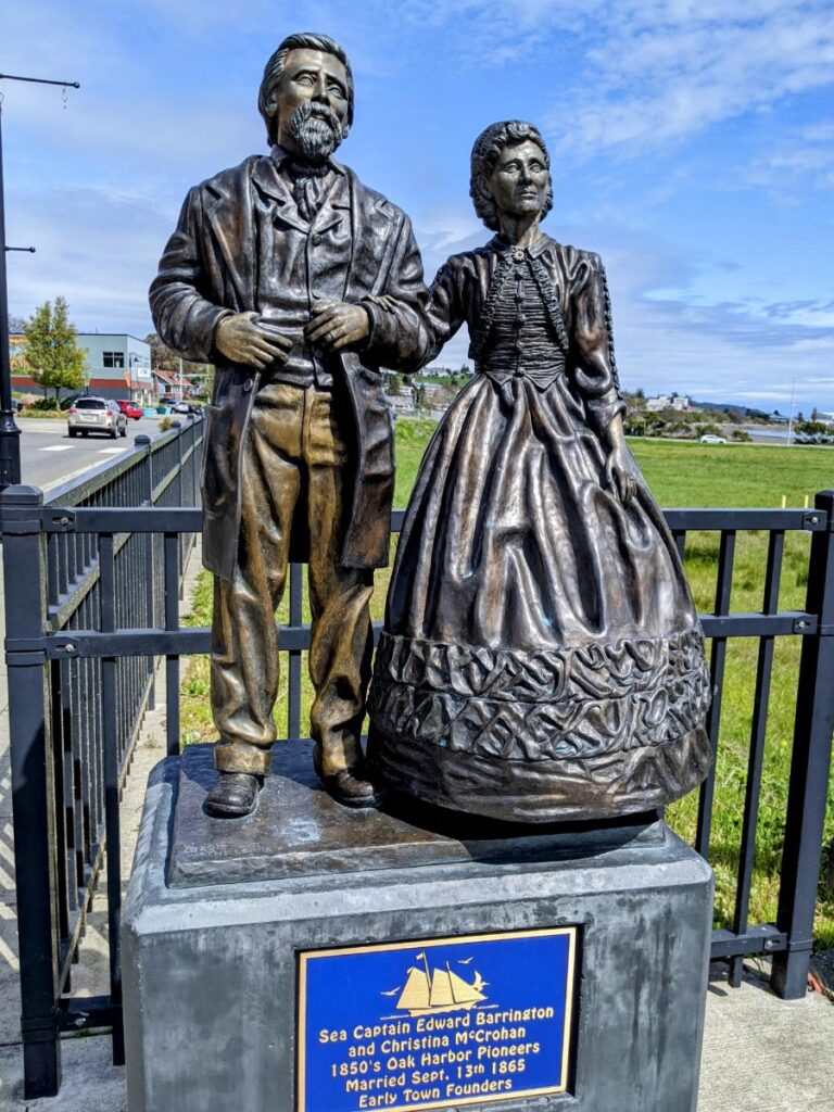
I stopped at a few cute small towns on the way, the first being Oak Harbor. There are lots of cute shops and restaurants, including a bookstore, the Wind & Tide Bookshop. Along the street are some interesting sculptures, including an impossibly buff Native man and a deeply skinny mermaid.
Towards the water is a very pretty river park with a ballfield and playground. There is also this “story trail” where you can read a children’s picture book at stops along the way. It is super sweet! I actually stayed in Oak Harbor for my trip out to Orcas Island, at the Auld Holland Inn. I can’t say I recommend it. It’s definitely in the you-get-what-you-pay-for camp and it’s very far from the harbor and downtown – and any tulips, for that matter. But the outside is kinda cute.
Coupeville
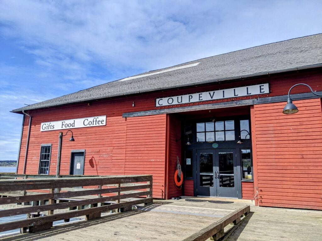
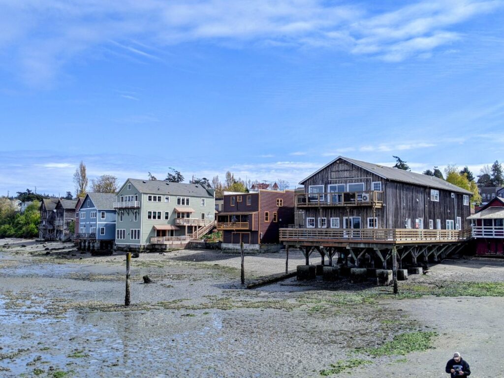
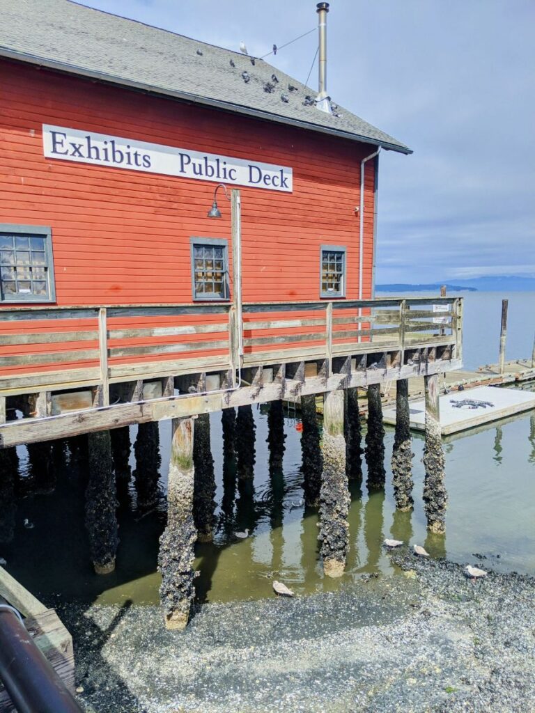
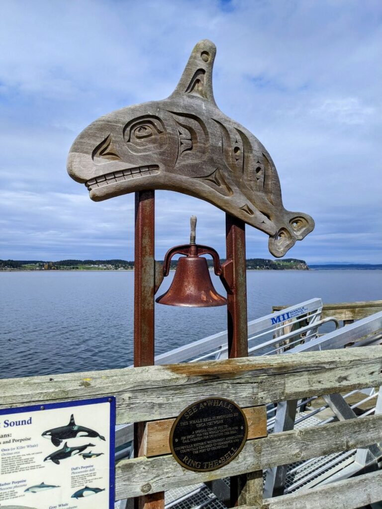
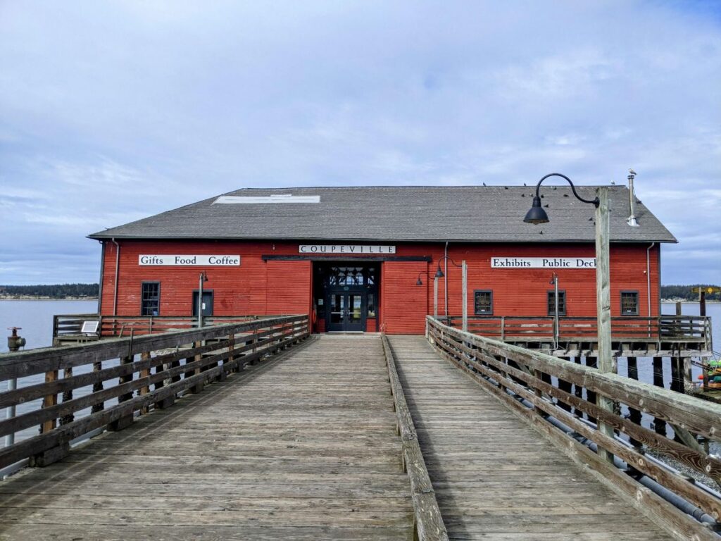
Farther south, around a mid-island cove, is Coupeville. It has a far cuter downtown area with more shops and restaurants, and a museum at one end. Jutting out into the water is a historic pier with more shops inside and a beautiful view of the water and town. If you happen to see a whale in the water, ring the whale bell!
I love that each of the buildings carries a plaque that says what it used to be. The Kingfisher Bookstore used to be a confectionary. Kapaw’s Iskreme used to be the original home of Seattle’s Best Coffee. Or maybe that was another building, I can’t quite remember. At any rate, you can tell independent bookstores, and often, ice cream, are my go-to in these small towns.
Whidbey Island continues farther south until you reach the ferry at Clinton. This one is only $12 per car and the 15-minute ferry takes you to Mukilteo. At that point, you’re basically in the Seatle suburbs. And that’s where I’ll leave you for now. I did a lot of sightseeing in Seattle that I’ll post about soon.
Wow, what a fascinating place! Cool history too. It’s so fascinating to see a place preserved in time.